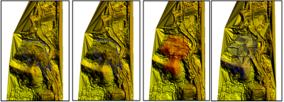
Volume Analysis of Mining Excavation Progress Using Unmanned Aerial Vehicle-Photogrammetry Method
DOI:
https://doi.org/10.24036/cived.v11i3.665Keywords:
Volume, UAV-Photogrammetry, Truck count, ExcavationAbstract
In recent years, the use of unmanned aerial vehicles (UAVs) has become an alternative for topographic mapping, and this is called the UAV-Photogrammetry method. Topographic mapping in mining activities is carried out to determine the progress of actual volume of material taken. However, in general, topographic mapping is carried out using terrestrial survey methods. These methods require a long data acquisition time and a lot of personnel. This paper focuses on surveying the volume of mining progress using the UAV-Photogrammetry method and compares it with truck count volume data. The results of this study showed that the deviation in volume calculations using UAV-Photogrammetry method compared with truck count volume data in week I was 233 m3 or 0.654%, week II was 214 m3 or 0.151%, week III was 496 m3 or 0.840%, and week IV was 243 m3 or 0.210%. The results of the t-test showed that there was no significant difference between the volume calculation using the UAV-Photogrammetry method and truck count data, which means both measurement types produce statistically similar results.
Downloads
References
K. Kokamägi, K. Türk, and N. Liba, “UAV Photogrammetry for Volume Calculations,” Agronomy Research, vol. 18, no. 3, pp. 2087–2102, 2020, doi: 10.15159/AR.20.213.
H. Eisenbeiß, “UAV Photogrammetry,” 2009.
P. Burdziakowski, “UAV in Todays Photogrammetry ? Application Areas and Challenges,” in 18th International Multidisciplinary Scientific GeoConference SGEM 2018, Jun. 2018, pp. 241–248. doi: 10.5593/sgem2018/2.3/S10.031.
P. Burdziakowski, “Towards Precise Visual Navigation and Direct Georeferencing for MAV Using ORB-SLAM2,” in 2017 Baltic Geodetic Congress (BGC Geomatics), IEEE, Jun. 2017, pp. 394–398. doi: 10.1109/BGC.Geomatics.2017.21.
K. Khomsin, D. G. Pratomo, and A. F. Akbar, “Analisa perbandingan volume dan ketelitian icp dari 3’s (TS, GNSS, dan TLS),” Geoid Journal of Geodesy and Geomatics, 2018.
A. A. A. Rahman, K. N. A. Maulud, F. A. Mohd, O. Jaafar, and K. N. Tahar, “Volumetric calculation using low cost unmanned aerial vehicle (UAV) approach,” IOP Conf Ser Mater Sci Eng, vol. 270, p. 012032, Dec. 2017, doi: 10.1088/1757-899X/270/1/012032.
P. L. Raeva, S. L. Filipova, and D. G. Filipov, “Volume computation of a stockpile - A study case comparing GPS and uav measurements in an open pit quarry,” in International Archives of the Photogrammetry, Remote Sensing and Spatial Information Sciences - ISPRS Archives, International Society for Photogrammetry and Remote Sensing, 2016, pp. 999–1004. doi: 10.5194/isprsarchives-XLI-B1-999-2016.
O. G. Ajayi and J. Ajulo, “Investigating the Applicability of Unmanned Aerial Vehicles (UAV) Photogrammetry for the Estimation of the Volume of Stockpiles,” Quaestiones Geographicae, vol. 40, no. 1, pp. 25–38, Mar. 2021, doi: 10.2478/quageo-2021-0002.
A. R. S. Aji and D.- Djurdjani, “Perbandingan Volume Stockpile Batu Bara Hasil UAV Fotogrametri dan UAV Lidar,” JGISE: Journal of Geospatial Information Science and Engineering, vol. 5, no. 2, p. 70, Dec. 2022, doi: 10.22146/jgise.78295.
A. E. A. Halim, A. A. A. Rahman, K. N. A. Maulud, M. S. Nekmat, and M. Mukhlisin, “Assessment of Difference in Structure from Motion for Stockpile Volume Estimation using UAV Approach,” in IOP Conference Series: Earth and Environmental Science, Institute of Physics, 2023. doi: 10.1088/1755-1315/1240/1/012002.

Downloads
Published
Issue
Section
License
Copyright (c) 2024 Helik Susilo, Aqil Rahardion, Martince Novianti Bani, Dyah Ayu Rahmawati Cupasindi, Muhammad Tri Aditya, Fuji Asema, Novita Anggraini

This work is licensed under a Creative Commons Attribution 4.0 International License.

