Comparison Model of Vegetation Index and Mangrove Density using Landsat 8 Satellite Imagery in Ujungpangkah
DOI:
https://doi.org/10.24036/cived.v11i3.610Keywords:
Mangrove, Landsat 8, NDVI, DVIAbstract
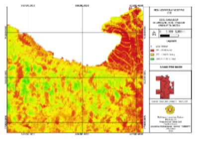
Gresik Regency is a coastal area with a significant mangrove population, notably in the Ujungpangkah region. The Ujungpangkah mangrove forest is a designated ecotourism and conservation area. However, due to management and utilization practices by the local community, the mangrove ecosystem in Banyuurip Village, Ujungpangkah District, has experienced a decline. This study aims to determine the mangrove density in Banyuurip Village using vegetation index transformation methods (NDVI and DVI). Assessing the density of mangrove vegetation is crucial for the effective management of mangrove forests to ensure they fulfill their ecological functions. The research employs a quantitative method, utilizing Landsat 8 imagery data to measure mangrove density using the NDVI and DVI methods. The study results indicate that the NDVI canopy density classification is 86.67%, divided into three classes: dense (569.700 ha or 95.32%), medium (29.910 ha or 4.50%), and sparse (1.080 ha or 0.18%). Meanwhile, the FCD classification results are 73.33%, also divided into three classes: dense (583.740 ha or 97.67%), medium (13.410 ha or 2.24%), and sparse (0.540 ha or 0.09%). The NDVI method proved to be the most accurate for classifying canopy density based on the accuracy test data
Downloads
References
B. M. Sukojo and Y. N. Arindi, “ANALISA PERUBAHAN KERAPATAN MANGROVE BERDASARKAN NILAI NORMALIZED DIFFERENCE VEGETATION INDEX MENGGUNAKAN CITRA LANDSAT 8 ( STUDI KASUS : PESISIR UTARA SURABAYA ) Pembangunan wilayah pesisir menyebabkan perubahan fungsi lahan menjadi kawasan pemukiman , i,” vol. 8, pp. 1–5, 2018.
S. Irawan and A. O. Malau, “Analisis Persebaran Mangrove di Pulau Batam Menggunakan Teknologi Penginderaan Jauh,” J. Integr., vol. 8, no. 2, pp. 80–87, 2016.
H. Ariadi, M. Fadjar, M. Mahmudi, and Supriatna, “The relationships between water quality parameters and the growth rate of white shrimp (Litopenaeus vannamei) in intensive ponds,” AACL Bioflux, vol. 12, no. 6, pp. 2103–2116, 2019.
S. S. A. Syukri, Muhammad Rijal, “Identifikasi Kerapatan Tutupan Mangrove Pulau Gusung Menggunakan Citra Landsat 8,” J. Sains Inf. Geogr. [JSIG], vol. I, no. November, pp. 40–43, 2018, doi: 10.31314/j.
S. Irawan and J. Sirait, “Perubahan Kerapatan Vegetasi Menggunakan Citra Landsat 8 Di Kota Batam Berbasis Web,” J. Kelaut. Indones. J. Mar. Sci. Technol., vol. 10, no. 2, p. 174, 2018, doi: 10.21107/jk.v10i2.2685.
K. K. Ahmad, K. A. Putri, A. D. Wilujeung, D. A. Lestari, and W. A. Arifin, “Status Sebaran Dan Kerapatan Kanopi Mangrove Di Pulau Tobea Besar Sulawesi Tenggara Menggunakan Data Satelit Landsat 8,” Pena Akuatika J. Ilm. Perikan. dan Kelaut., vol. 20, no. 2, 2021, doi: 10.31941/penaakuatika.v20i2.1363.
Izzatinnisa and U. dan A. M. Utami, “Keanekaragaman Burung di Kawasan Hutan Mangrove Banyuurip Kecamatan Ujungpangkah Kabupaten Gresik,” J. Ris. Biol. dan Apl., vol. 2, no. 50, pp. 18–25, 2020.
M. Waruwu, “Pendekatan Penelitian Pendidikan: Metode Penelitian Kualitatif, Metode Penelitian Kuantitatif dan Metode Penelitian Kombinasi (Mixed Method),” J. Pendidik. Tambusai , vol. 7, no. 1, pp. 2896–2910, 2023.
D. Kosasih, I. Nasihin, and E. R. Zulkarnain, “Deteksi Kerapatan Vegetasi dan Suhu Permukaan Tanah Menggunakan Citra Landsat 8 (Studi Kasus : Stasiun Penelitian Pasir Batang Taman Nasional Gunung Ciremai,” Konserv. untuk Kesejaht. Masy., vol. 1, pp. 162–173, 2019.
A. Sukmono, A. S. Pratama, and L. Sabri, “Analisa Perubahan Kerapatan Vegetasi Pada Das Blorong Menggunakan Metode Forest Canopy Density (Fcd) Dari Citra Landsat 8,” Elipsoida J. Geod. dan Geomatika, vol. 3, no. 01, pp. 92–97, 2020, doi: 10.14710/elipsoida.2020.8051.

Downloads
Published
Issue
Section
License
Copyright (c) 2024 Shaktiawan Lawyerrisa Prakoso, Hendrata Wibisana

This work is licensed under a Creative Commons Attribution 4.0 International License.

