
Theodolite and Drone Training to Enhance the Digital Mapping Competence of Teachers and Students at SMKN 1 Lubuk Sikaping
DOI:
https://doi.org/10.24036/521c0g94Keywords:
Drone, Theodolite, Unmanned Aerial Vehicle, Lay-Out, SurveyingAbstract
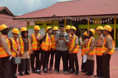
In the era of Industry 4.0, UAV (Unmanned Aerial Vehicles) have become key technologies used widely, not only for military operations but also for mapping, monitoring volcanic activity, and producing documentary videos. Two tools advancing rapidly and highly relevant to vocational education are drones and theodolites. Their adoption in vocational schools still lags behind, especially in rural areas, so Geomatics teachers need capacity building to update Land Surveying course materials and transfer practical skills to students. This science and technology outreach program aims to equip teachers at SMK Negeri 1 Lubuk Sikaping with foundational knowledge and skills for operating drones and theodolites, along with data analysis for aerial mapping. The training is arranged sequentially, beginning with an introduction to platforms, sensors, operating principles, and safety; continuing with field practice covering mission planning, control point acquisition, and calibration procedures; and concluding with data and video processing for construction project needs, including georeferencing, orthomosaic generation, elevation modeling, and extracting relevant measurements. The targeted outputs include scientific publications in ISSN journals or national proceedings, an activity video of about 3 to 4 minutes, and coverage in print or online media. Through this program, the gap in technology and information mastery is expected to narrow, the curriculum to become more current, and teachers’ pedagogical and technical competencies to improve, particularly in structural and mapping applications. Graduates under their guidance will be better prepared to enter industry with strong spatial literacy, careful data acquisition, and a solid safety culture.
Downloads
References
[1] Colomina and P. Molina, “Unmanned aerial systems for photogrammetry and remote sensing: A review,” ISPRS Journal of Photogrammetry and Remote Sensing, vol. 92, pp. 79–97, 2014.
[2] F. Nex and F. Remondino, “UAV for 3D mapping applications: A review,” Applied Geomatics, vol. 6, no. 1, pp. 1–15, 2014.
[3] P. Barry and R. Coakley, “Field accuracy test of RPAS photogrammetry,” International Archives of the Photogrammetry, Remote Sensing and Spatial Information Sciences, vol. XL-1/W2, pp. 27–31, 2013.
[4] E. Seifert, C. Seifert, F. Vogt, and M. Drewes, “Influence of drone altitude, image overlap, and optical sensor resolution on multi-view reconstruction of forest images,” Remote Sensing, vol. 11, no. 10, p. 1252, 2019.
[5] Bakri, Y. Sugiarti, and D. Wahyudin, “Readiness of Indonesian TVET teachers in receiving GIS technology using TAM 2,” INVOTEC, vol. 16, no. 2, pp. 104–120, 2020.
[6] E. T. Winanti, I. Kustini, R. E. Wibisono, A. S. Primadani, and N. A. Hanifah, “Pelatihan pengolahan data hasil pengukuran waterpass, theodolit, total station bagi guru TKP SMK wilayah Kabupaten Jombang dan sekitarnya,” Jurnal Abadimas Adi Buana, vol. 5, no. 2, pp. 242–252, 2022.
[7] M. P. Nanda, A. B. Septianingrum, and H. N. Haryani, “Pelatihan penggunaan alat theodolite untuk pembelajaran ilmu ukur tanah,” J-PIS (Jurnal Pendidikan Ilmu Sosial), vol. 11, no. 2, pp. 150–157, 2024.
[8] U. Umroh, M. Hudatwi, L. O. Wahidin, A. Pamungkas, I. Akhriati, and E. Utami, “Pelatihan pengoperasian drone sebagai peningkatan kemampuan kompetensi SMK Perikanan Tukak Sadai Bangka Selatan,” Jurnal Ilmiah Pangabdhi, vol. 10, no. 1, pp. 379–384, 2024.
[9] H. Ikhsani, M. Ikhwan, and E. Sadjati, “Pelatihan pengoperasian drone sebagai peningkatan kompetensi siswa SMK Kehutanan Negeri Pekanbaru,” Abdimasku, vol. 8, no. 2, pp. 774–782, 2025.
[10] Andrian, R. P. R. Hutasoit, T. A. Purba, and A. A. Siregar, “Pelatihan penerbangan pesawat drone untuk siswa SMK Al Farabi Medan,” Jurnal Pengabdian kepada Masyarakat (JAPAMAS), vol. 3, no. 2, pp. 158–165, 2023.
Downloads
Published
Issue
Section
License
Copyright (c) 2025 Nevy Sandra, Emilham Mirshad, M. Giatman, Yuan Nifer Harada

This work is licensed under a Creative Commons Attribution 4.0 International License.